Lead Forecaster Daniel Crawley
The weather across Western North Carolina has been for the most part lackluster in recent times. Severe weather has been limited and we have seen a switch back-and-forth between very mild weather and spurts of cool weather.
Starting this weekend and especially into next week we are heading toward a sustained cooler than normal pattern across the southeast. Average high temperatures for late April are in the lower to mid 70’s and 40’s at night.
So, what’s going to cause the change?
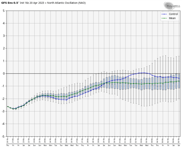
It appears that we will have some high latitude ridging and Western North America ridging help funnel the lower heights into the Eastern and Southeast US. A (-NAO, +PNA) teleconnection usually means colder weather…


Current model synoptics is falling in the line with the idea of West Coast ridging, blocking to the North and forcing lower heights down into the Mississippi River Valley and Southeast US next week…

While this does support cooler than normal weather, it could be more a product a increased precipitation rather than abnormally cold weather.


In summary, be prepared for temperatures around 70 or below starting late this weekend and going into a large part of next week. Also, be mindful that some increased rainfall may occur…check our 7-Day forecast updated daily for details!
