Lead Forecaster Daniel Crawley
Good Thursday morning. We are in a stuck weather pattern right now, sunshine has been very little over the past several days and we are starting your Thursday much the same.

So, what is causing this?
Basically the Southeast US is caught in a conveyor belt between height patterns located over Canada and the Gulf of Mexico. That is resulting in prolonged fast zonal flow at the jet stream level full of shortwave energy and moisture.
At the surface, northeast winds pushed cooler, dry air into the region earlier in the week and once the moisture began to overrun the surface airmass it resulted in a lot of clouds!

The bad news is this pattern may remain with us through the upcoming weekend as a couple more shortwaves will impact the Carolinas.
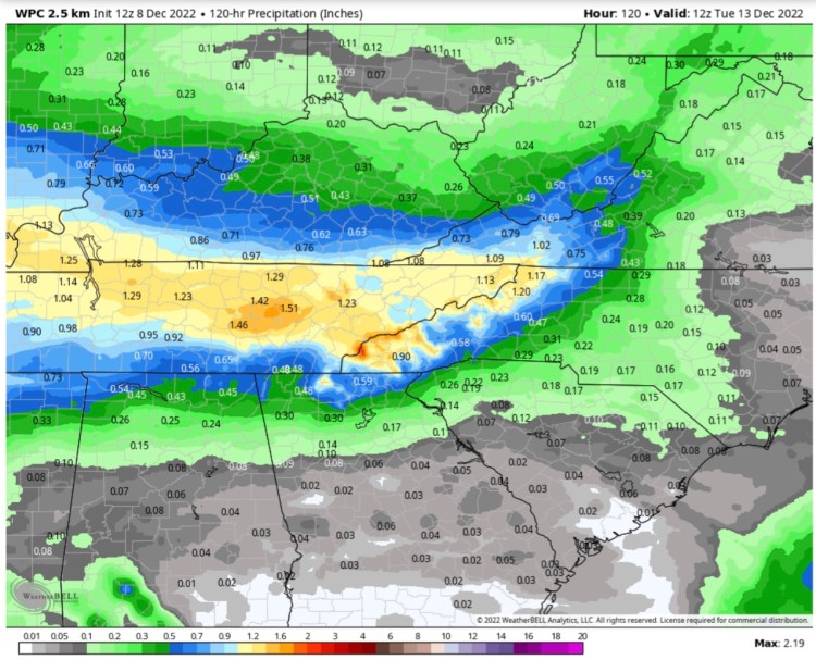
Heaviest rainfall still appears to lie west of the Appalachians but you can’t rule out .25 to .50 here locally through Sunday. Best chances along the Blue Ridge.

Tonight in a separate blog post we’ll go into detail about next week and where the overall Synoptics may trend in the longer range. Stay tuned!
