
Lead Forecaster Daniel Crawley
Good Sunday morning to everyone, the first part of the Labor Day Weekend across Western North Carolina has pretty nice from a weather standpoint but some changes are on the way starting today.
At the time this discussion is being written (pre daybreak) a few light rain showers has moved north up into the High Country. We are going to see more of where that came from as rich Atlantic and Gulf Moisture aloft has moved into the Foothills.
Looking at the Synoptics we have a slowly developing upper low across the Mississippi River Valley and a departing 500mb ridge off the Mid-Atlantic. This is producing a nice southeast fetch that will lift up against the Blue Ridge Escarpment.
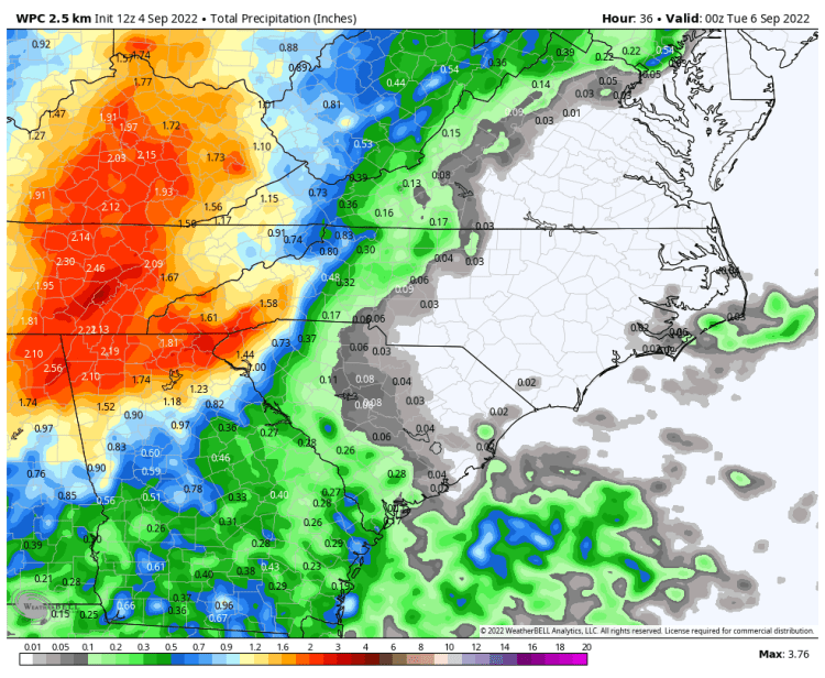
That combined with Precipitable Water Values in the 1.7 – 1.9 inch range are the ingredients needed to start introducing heavy rain potential across the Blue Ridge starting today and into Labor Day itself.

Short range guidance is picking up on the heavy rain threats especially tomorrow across the mountains and immediate foothill locations of Rutherford, McDowell and Burke Counties.
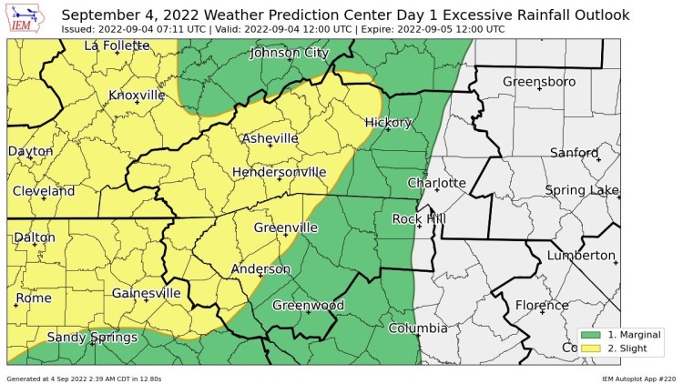
The Weather Prediction Center has highlighted the escarpment region with a Day 1 Slight Risk of Excessive Rainfall.
Be Weather Aware especially if you have outdoor plans over the next 24-48 hours!