
Lead Forecaster Daniel Crawley
Good Saturday evening to everyone across the region. The first half of this weekend actually turned out to be pretty nice as a whole. We all got to see a good amount of sunshine early in the day and thunderstorm coverage was limited. Plus, temperatures have remained below normal for the latter third of August.
Sunday is not going to be as nice thanks in part to a surge of subtropical moisture and the next shortwave energy diving down across the Midwest.
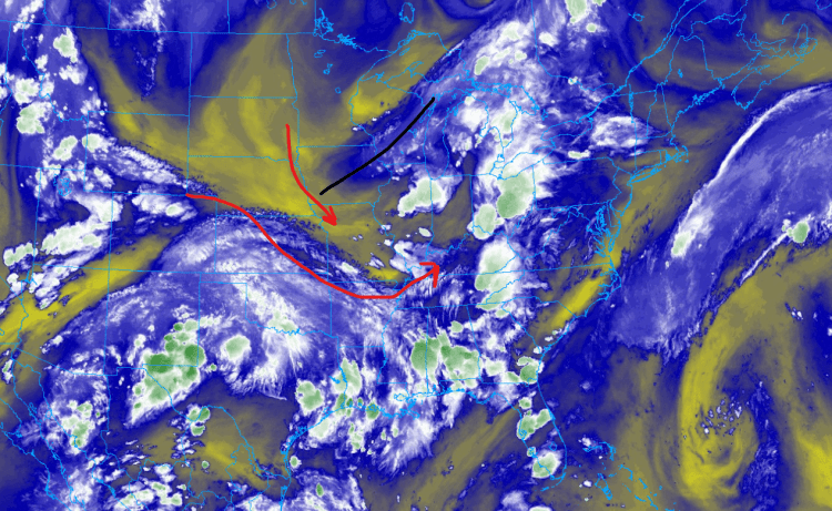
Looking at the water vapor image a closed off upper low across the Upper Midwest is slowly opening up into a trough axis. That axis will shift southeast and then sweep east over the next 24-48 hours. You can also see aloft how the flow tonight is bending to the southwest across the Tennessee Valley. Meanwhile a plume of subtropical moisture of the back side of the Bermuda High will get entrained into the upper level flow.
The combination of all features is going to lead to a wet, cloudy, cool Sunday across the region…
Sunday could begin on the wet side especially in the mountains and right along the Blue Ridge as a cluster of showers and storms will be embedded within the mean flow. Then in the afternoon with daytime heating additional mesoscale boundaries will activate leading to scattered to numerous storm coverage. Severe Weather potential should remain limited in scope along with the excessive rainfall potential.
Full forecast details and be found by clicking on the button below!