Good Friday morning, we continue to monitor our next storm system and how it may impact the region.
A trough in the Western US will eject east tomorrow, at the surface a cold front will fire up showers and thunderstorms layer today. A few of those could be severe along Mississippi River Valley and Mid South. All of that activity translates toward the east on Saturday to impact our area.
Model Timing (Saturday)
The cold front is expected to move into the mountains by early afternoon…

Temperatures in the early afternoon will be quite warm, in the upper 60’s and lower 70’s. That will actually provide a little surface instability in the early afternoon. A rumble of Thunder can’t be ruled out with the passage.


By late afternoon the leading edge of the front will be near the Charlotte Metro area.

And then by evening the front has passed with some leftover showers continuing…

Storm Prediction Center has issued a Day 2 Marginal Risk (Level 1 of 5) for Western North Carolina. Damaging Winds would be the primary threat if anything materializes.

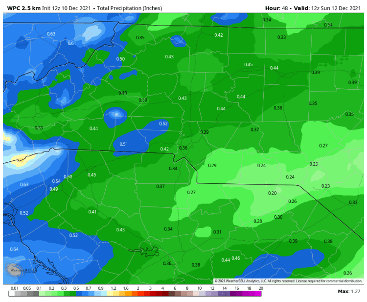
Precipitation Amounts
As we talked about earlier this week, Saturday’s cold front has the potential to end a long streak of dry days across the Western Carolinas. At this time we still expect amounts to be on the .25 to .50 inch amount on average.
After the frontal passage it appears that we go into another extended dry spell, most likely through all of next week. Any rain tomorrow would be appreciated!