In terms of the tropics, the past few weeks have been very quiet across the Atlantic Basin as the global weather patterns has featured a lull in activity.
However that is changing quickly now that we are approaching the heart of the Atlantic Hurricane Season. Today the National Hurricane Center has designated a disturbance as (PTC) Potential Tropical Cyclone Six.
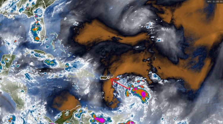
The feature is located just to the east of the Lesser Antilles moving toward the WNW. This feature will continue on that heading over the next few days and could become a Tropical Storm before interacting with Hispaniola. If it does that, the name “Fred” will assigned.
The Hurricane models are being used for this feature and as you can see will continue WNW for the next few days, there is fairly good confidence in that.

The forecast strength will be heavily dependent on the ultimate interaction with the islands of the Caribbean including Puerto Rico, Hispaniola and Cuba.
By the time we get to the weekend, interest will begin to shift toward the United States as this feature should be somewhere in the vicinity of the Western Caribbean or Florida Straights.
Current guidance indicates that ridging will be fairly persistent in the Western Atlantic Ocean so the odds of this being picked up and sent up the East Coast looks to be relatively low. This feature, in whatever shape or form looks destined to get into the Gulf of Mexico at some point.

The good thing is that we have several days to watch this as it evolves. We’ll keep you updated through the week on the status of PTC 6.