
Lead Forecaster Daniel Crawley
Good Friday evening to everyone, hope your weekend is off to a great start. Lets talk about the weather for the upcoming weekend along with the next weather feature expected on Monday.
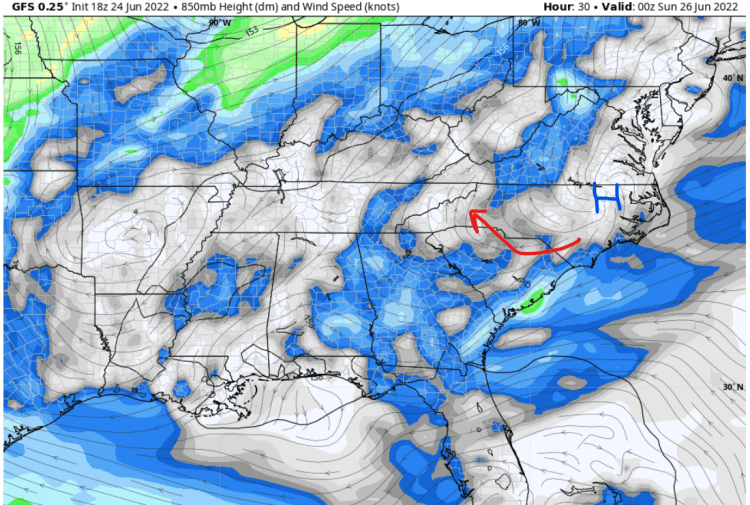
There is a 500mb ridge located to our west and that is forcing northwest winds across Western North Carolina at about 10, 000-15,000 ft. altitude. Meanwhile at the 850 mb level (roughly 5,000 ft) we are seeing a light easterly component as high pressure is located across Central North Carolina…

That general look at 850 mb will continue through early Sunday across Western North Carolina. The end result is a humid airmass with temperatures (Mid 80’s/Mid-Upper 60’s) close to normal for late June and convective chances highly dependent on terrain and any leftover outflow boundaries.
It’s not until Sunday Night and into Monday where things change, a trough across the northern tier of the US will drop a surface boundary toward the Carolinas.

That will serve as the trigger for additional storm coverage on Monday. The front and resulting trough will pool a lot of moisture across the Interior Southeast. As you can see on the projected Precipitable Water Values, we are look at PWAT’s in the 1.8 – 2.1 range which is very efficient for heavy rain producers and wet microbursts.
A look at our Pool Weather Index illustrates well how the weather should be overall this weekend, with Monday potentially being a very active day.
